


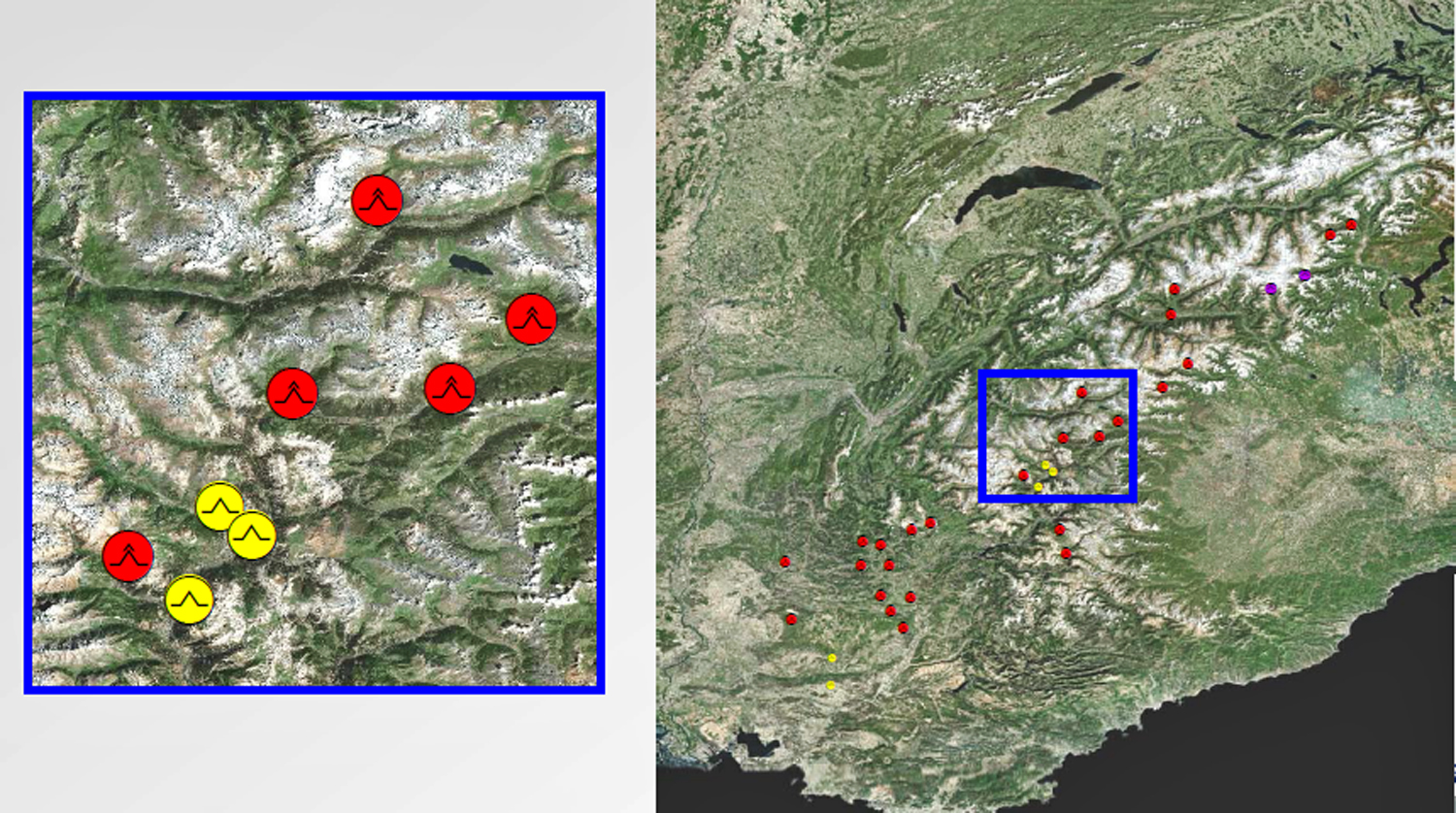
Regional overview of the system Rotor - Wave
Cataloging of over 200 global positions of Rotor-Wave systems and their visualiziation in a Geographical Informations System (GIS). For the graphical representation every user can activate the free GIS-Viewer ArcGIS Explorer Desktop. The regional layer files and packages of the MWP (vector data) contain the following features due to the observational turbulence research of pilots :
-
name of the origin (mountain range) concerning mountain wave phenomenom and the country code ISO- 3166-1 ALPHA 3
-
height of the rotor [m]
-
vertical velocity [m/s] and geographical coordinates of the system rotor-wave
-
main wind direction over the mountain areas and synoptical situation
-
additional informations (altitude records, light/moderate/severe turbulence, position in reference to the airfield, entry points of the wave)
-
source/authority of the report
Examples (experimental overview with ArcExplorer)
-
Regional overwiew of global empirical positions (examples)
-
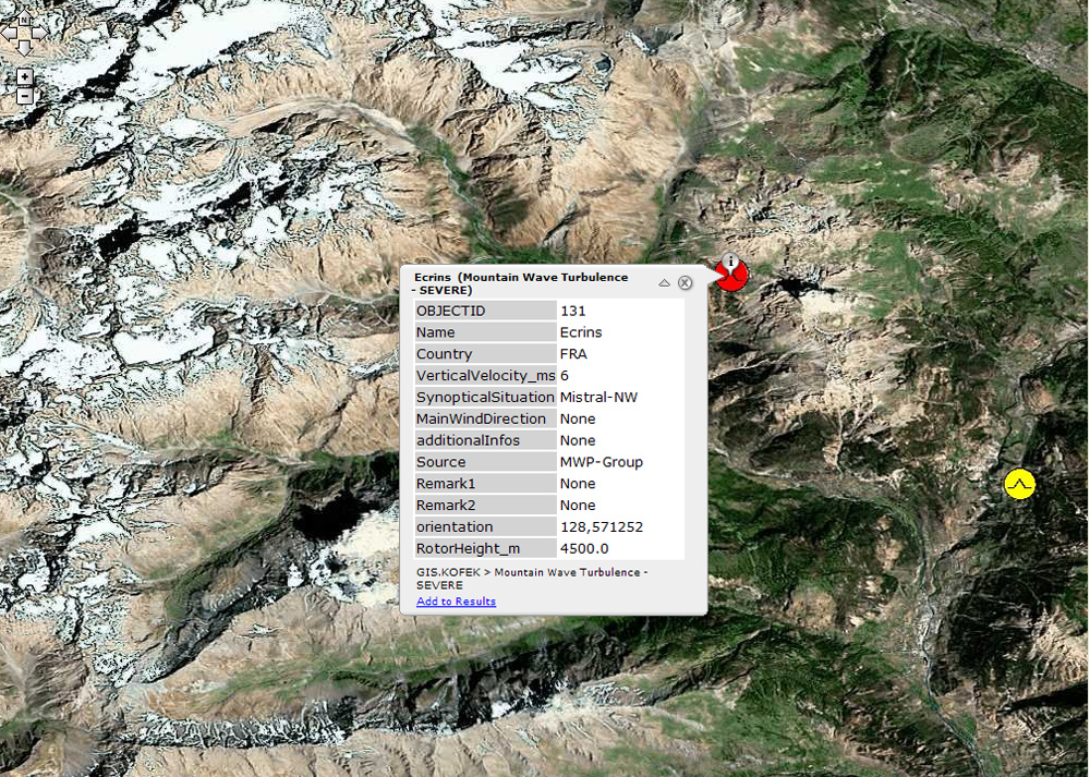
 Ecrins (France)
-
-
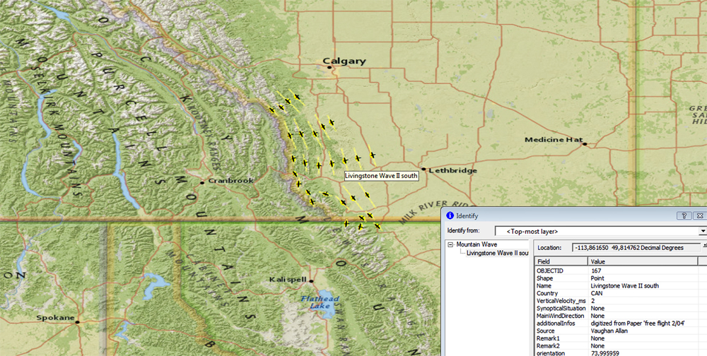
 Livingstone - Calgary (Canada)
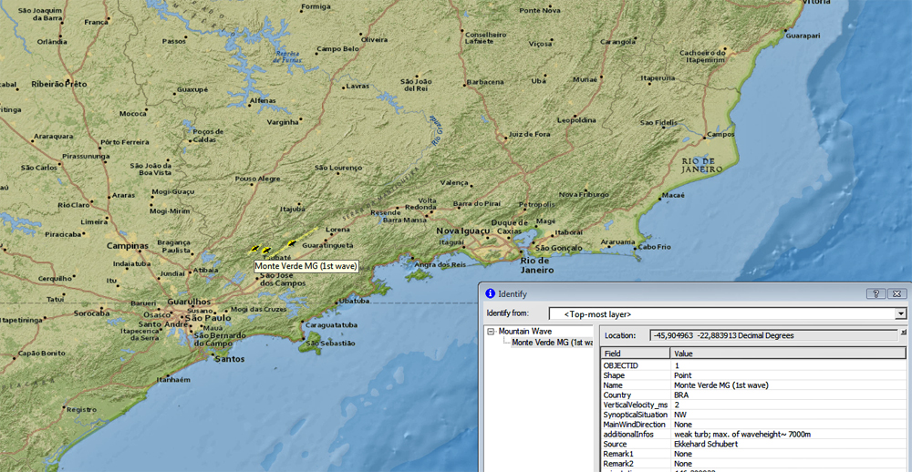
  Monte Verde (Brasilia)
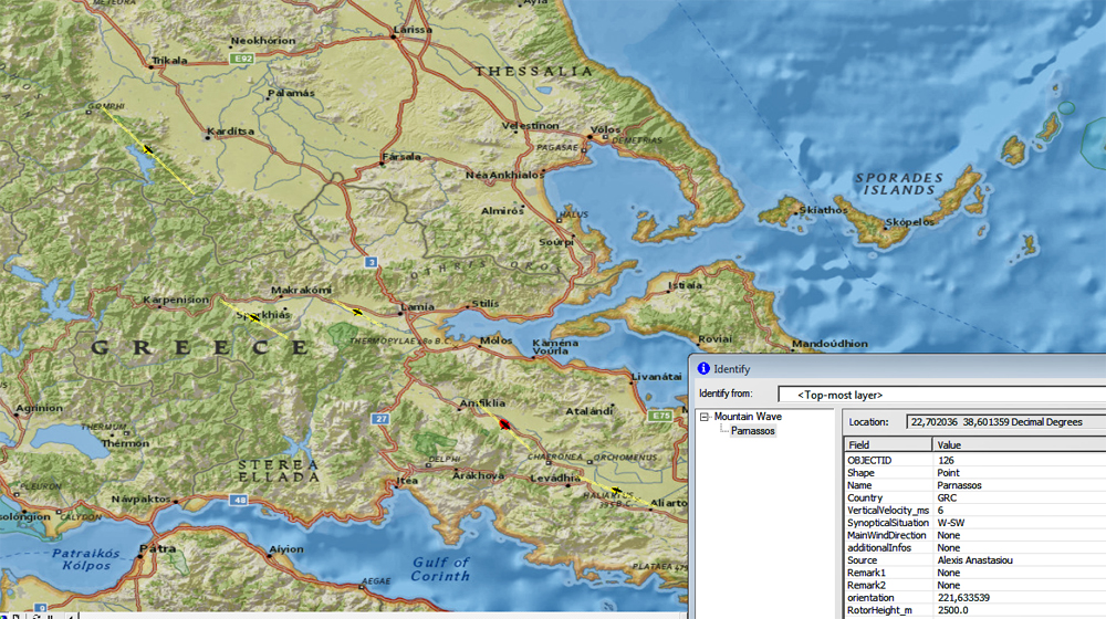 Overview Greece
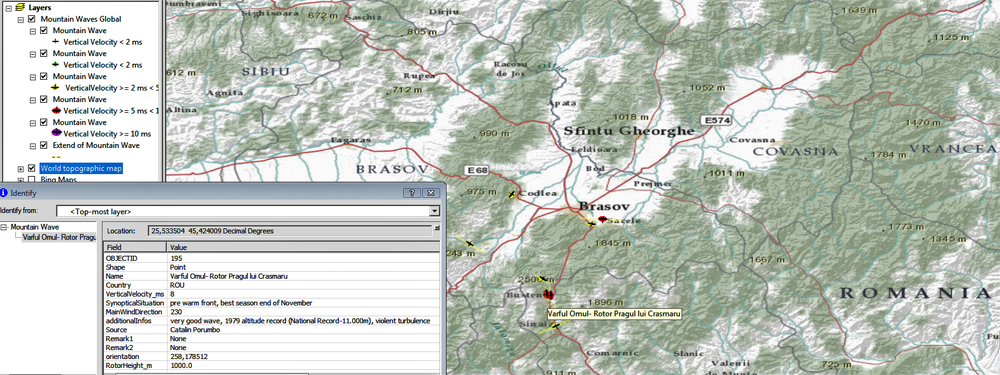 Carpathian Mountains (Romania- National Altitude Record)
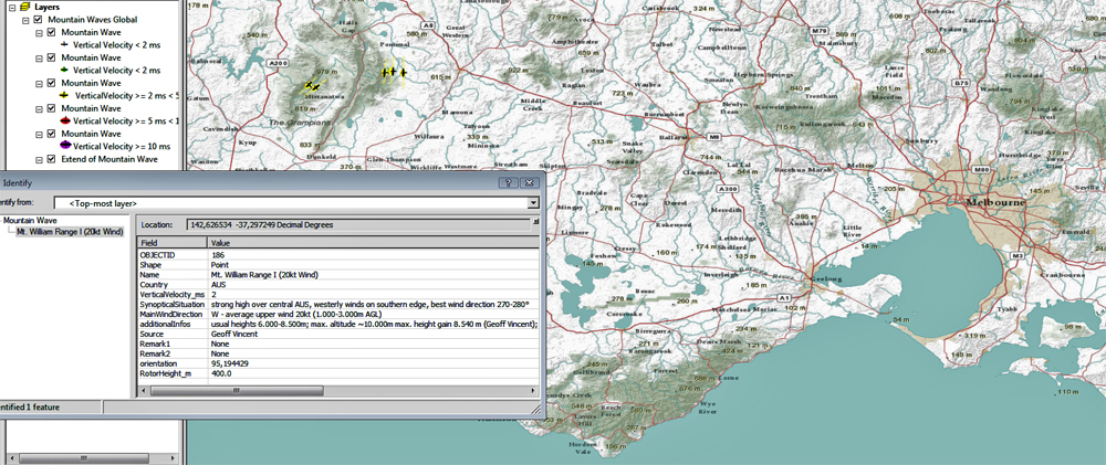 Mt. William Range (Australia)
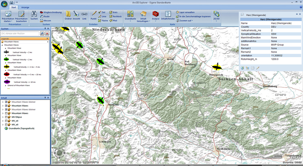
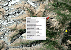
 Lausitzer Gebirge
(Germany)
Lausitzer Gebirge
(Germany)
 Odenwald (Germany)
Additional Informations
-
ArcGISEXplorer (GIS-VIEWER) - ESRI freeware
- EMPIRICAL POSITIONS SYTEM ROTOR-WAVE GERMANY (VECTOR DATA BASE - *. LYR FILE)
GIS Viewer ArcExlorer Desktop
ArcExplorer- Installationshinweise (Deutsch)
1.) Systemanforderungen (Hardware- und Softwareanforderungen, speziell Microsoft .NET Framework 3.5 Service Pack 1 bzw. Microsoft XML Core Services (MSXML) 4.0 Service Pack 2) prüfen
2.) Herunterladen der Software ArcGIS Explorer Desktop
3. ) Ggf. muss rür die Darstellung der entspr. (Ellipsen, Turbulenzzeichen) bzw. ArcGIS Layer Dateien noch das ESRI FONTS EXPANSION PACK installiert werden. Fonts Expansion Pack für ArcGIS Explorer Desktop (Build 1750) herunterladen
3.) Programmstart von ArcGIS Explorer Desktop
4.) Download der Datei (ESRI Layer Package) mit den MWP-Wellenpositionen (Testdatensätze - ohne Gewähr!)
-
Layer Package Deutschland* (Ellipsensymbolik) - Mountain Waves Germany.lpk
-
Layer Package Deutschland* (Turb-Symbol) bei Wetterlagen mit östl. Windrichtungen - MTW_DEU_from_East (Stand März 2012)
-
Layer Package Deutschland* (Turb- Symbol) bei Wetterlagen mit westl. Windrichtungen- MTW_DEU_from_West (Stand März 2012)
-
Layer Package DEU - FRA- ITAL- ROU* mit Turb-Symbolik - MTW_DEU_FRA_ITA_ROU_TurbSym.lpk (Stand März 2012)
* © MWP
und anschl. diese Datei über das Menü "Inhalt hinzufügen" => ArcGIS-Layer auswählen und importieren
Hinweis: Zusatzinfos (Rotorhöhe, synopt.Situation, Vertikalgeschw., ... ) über Doppelklick mit der Maus auf das Turb-Symbol