


Data Mining to distinguish Wave vs. Thermal Climbs in Soaring Flight Data
* Excerpt of lectures and papers
Heise, R., Hacker, J., Ultsch, A. (2011): How to obtain a large database of measurements on atmospheric gravity waves, American Geophysical Union Chapman Conference, Atmospheric Gravity Waves and Their Effects on General Circulation and Climate, Honolulu
Ultsch, A., Heise, R. (2010): Data Mining to Distinguish Wave from Thermal Climbs in Flight Data, 34th Annual Conference of the German Classification Society (GfKl), Karlsruhe
Motivation
Determination of vertical velocity Vz using IGC- Files
-
in contrast to high resolution airborne measurements we like to derive Vz in IGC-Files with an use of a statistical analysis.
- in connection with measurements of Vz it is necessary to know
exactly the real flight attitude and the upstream flow angle with
an accuracy of tents degree and a time resolution at least of 10Hz
Data base
Data evaluation of ~ 126 MWP- Flights (1999-2010) over the Andes (region San Juan – Fireland, 2.500km) to filter out structures of waveclimbs in IGC-Files.
IGC-Logger: GPS – logger to storaging the time, geographical longitude/latitude (WGS-84), GPS-height, barometric height in a data format of the International Gliding Commission (IGC;1995) with a time lag of 1-15 sec.
1. Location of climbs in an IGC-file
With a tool we are identify climbs-times, where we ascend due to lifts (thermals/wave/ridge).
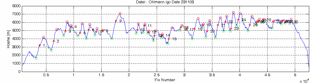
2. Calculation of distance within the climb
south 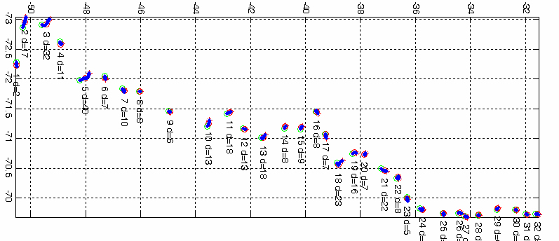 north
north
east
( i.e. has the climbs 10 a distance of d = 13 km)
3. Estimation of limits for determination between wave and thermals
The distinction is made on the basis of the climb in the distance traveled d and the height of the base points. To calculate a decision boundary for the distribution of d we are using a Gaussian mixture. As a decision limit are taken the Bayes decision boundary.

Decision limit for d is by ~ 2.8 km
4. Estimation of limits for the determination between waves and thermals
…contains the search for plausible separating functions!

5. Decision limit for base points of climbs
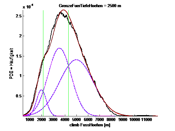
The decision limit for base points is by~ 2500 m
6. Classification of climb rates
From all IGC-Files we are searching for fixes, which we can find in a climb:
whose base points are > 2.500 m,
whose covered a distance > 2.8 km
This fixes will be considered as points which we founded and used as a wave.

As limits to climb classes can therefore apply: 2.0, 5.0 und 7.5 m/s
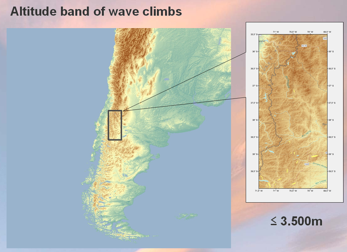
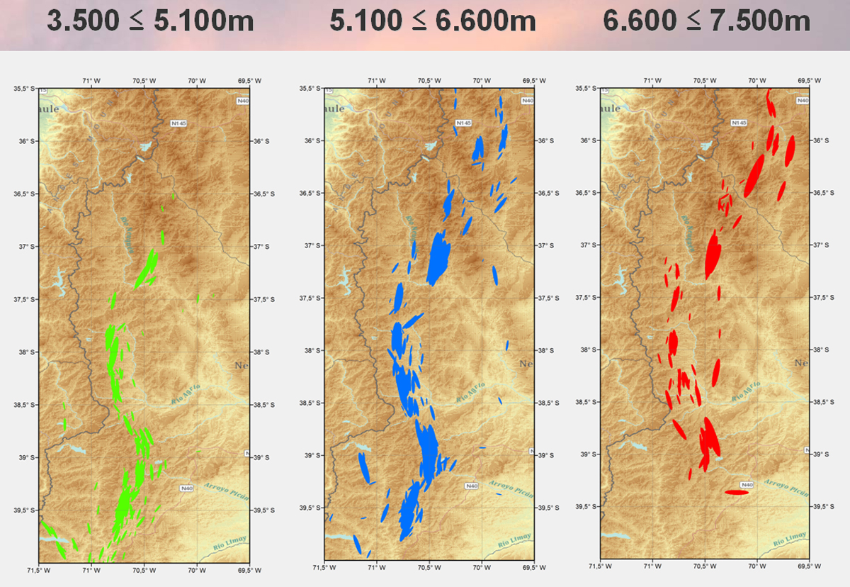
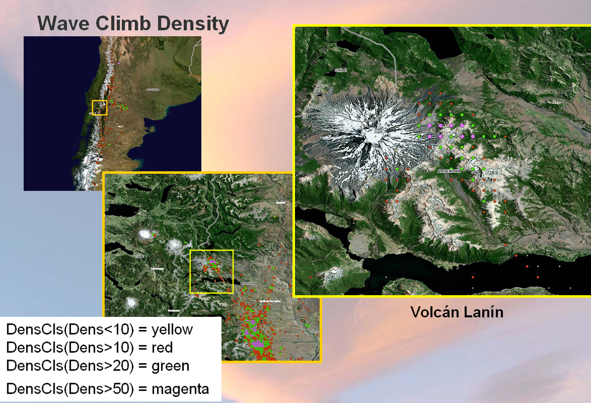
Some graphics for the region of the Andes
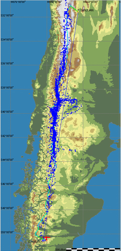 More than 4.083 wave climbs – over the Andes (Nov - Jan; 1999-2010)

Additional Informations
-
Data bionics - philipps university of Marburg
-
Identification of lee waves in logger files of soaring flights over the alps - Philip Ohrndorf (in German)
-
Understanding Mountain Gravity Waves Helps Optimize Glider Flights over the Andes - Heise, R. (2011) ArcNews-Magazine, p.32